

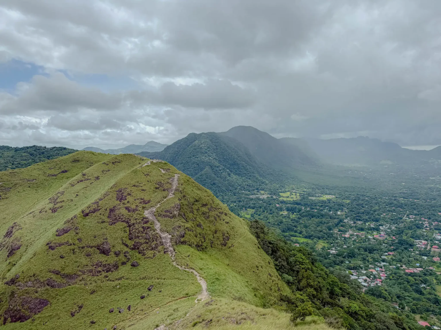
Valle de Anton sits inside the crater of an extinct volcano, and the hiking here reflects that geography in ways that make every trail feel more dramatic than the numbers suggest. You are not climbing a mountain from a flat base. You are climbing the interior walls of a caldera roughly six kilometers wide, and when you reach the ridge, the crater opens beneath you on one side while the outer slopes fall away on the other. The views are unlike anything else in central Panama. If you enjoy this kind of landscape and want to spend more time in a region, consider discovering Boquete, located further from Panama City.
We hiked all three main trails during our time in Valle de Anton: India Dormida and La Piedra Pintada, Cerro La Silla, and Cerro Cara Iguana. Here is what we found on each one, along with the practical information that most guides leave out. (Cerro Gaital is another popular hike in the region but it is only available during the dry season and is significantly more challenging than the hikes described in this article.)
For the town itself, hot springs, and how to get there from Panama City, read our Valle de Anton guide.
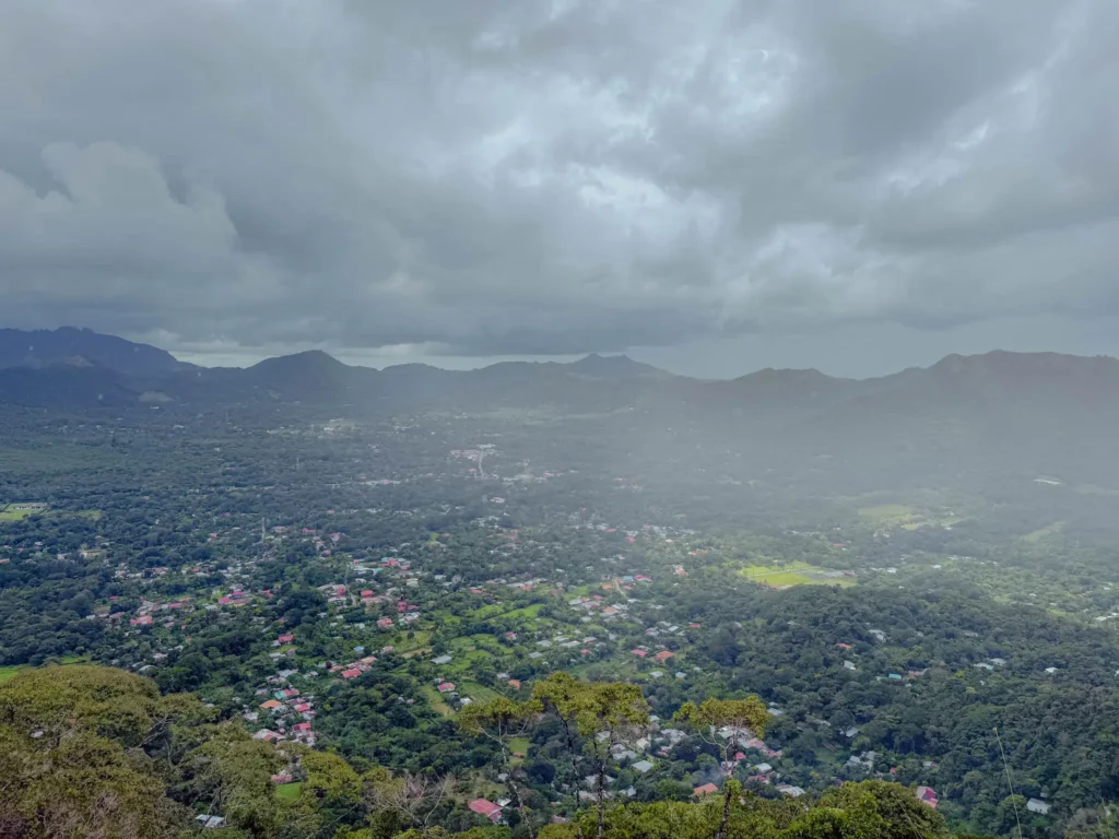
Valle de Anton sits at around 600 meters elevation inside one of the largest inhabited volcanic craters in the world. The volcano last erupted roughly 300,000 years ago, and the ridges you see ringing the town are the remains of its rim. Hiking here means walking those ridges. Three main trails are worth your time: India Dormida and La Piedra Pintada, Cerro La Silla, and Cerro Cara Iguana. Each one sits on or above the crater rim and rewards you with elevated views down into the valley. Together with a handful of shorter walks in town, they form the heart of what locals call the Ruta de la Caldera, or Crater Route.
India Dormida and Cerro La Silla charge a small entrance fee of around $3 to $5 per person, payable at the trailhead. Two of them, India Dormida and Cerro Cara Iguana, are walkable from the town center. La Silla requires a short minibus or taxi ride to reach the trailhead.
The three trails have genuinely different characters, different difficulty profiles, and different payoffs. The sections below break down each one, and the final section of this guide covers how to combine two of them in a single day.
A note on AllTrails: the routes for all three trails are available on AllTrails → and we recommend downloading them before you leave Panama City. Signage on the trails ranges from adequate at the trailhead to minimal once you are on the route. Having the map on your phone is not essential, but it is useful.
India Dormida is the most famous hike in Valle de Anton and the trail most visitors recognize. When you stand in the valley and look up at the ridge to the north, you can see the silhouette of a reclining woman in the shape of the mountain. That ridge is where you are headed.
The legend of the Sleeping Indian (India Dormida)
The mountain takes its name from a Panamanian legend. The story goes that Flor del Aire, daughter of the indigenous chief Urraca, fell in love with a Spanish conquistador during the time of the conquest. Her father forbade the relationship, and a warrior of her own tribe named Yaravi, who loved her, threw himself from the mountain in despair when she refused him. Heartbroken and unwilling to betray her people, Flor del Aire wandered into the mountains until she died of grief. The ridges, the legend says, took the shape of her body in memory of the story. From town you can trace her forehead, her chest, and her feet along the skyline. And you can see the ridge outline even better from the viewpoint of the Cerro Cara Iguana trail.
You do not need to believe the legend to feel its presence. It is the cultural anchor of the entire region.
The trail
The trailhead is on the Piedra Pintada side, which translates to painted rock, and it is walkable from the town center. You will pay the entrance fee at the gate before heading in.
The hike to the summit is 1 mile of continuous uphill climbing with 955 feet of elevation gain. There is no gradual warm-up section and no reprieve once you start. It is a short hike in distance and a significant one in effort. Our total walking time for the out-and-back was around 2 hours, which gives you a sense of how demanding the ascent is relative to the mileage.
We recommend doing this as an out-and-back (2.1 miles) rather than the loop (2.5 miles). The trail that closes the loop from the top of the ridge back down to town is poorly marked and extremely steep in a way that is uncomfortable rather than challenging. The out-and-back via the Piedra Pintada side is the better choice in both directions.
La Piedra Pintada and Chorro el Escondido
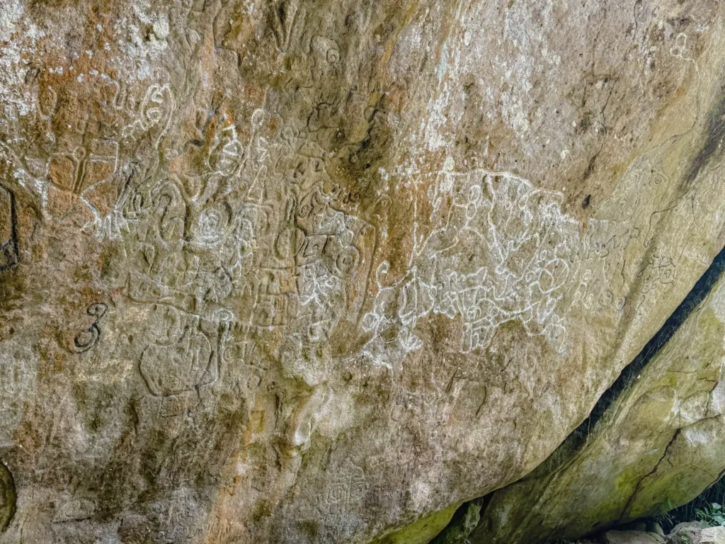
Before you commit to the full ridge climb, La Piedra Pintada itself is worth a stop. These are pre-Columbian petroglyphs carved into a large rock face, with symbols and figures that are still clearly visible. They are the oldest human marks in Valle de Anton and a reminder that this caldera has been inhabited long before any of the present-day infrastructure.
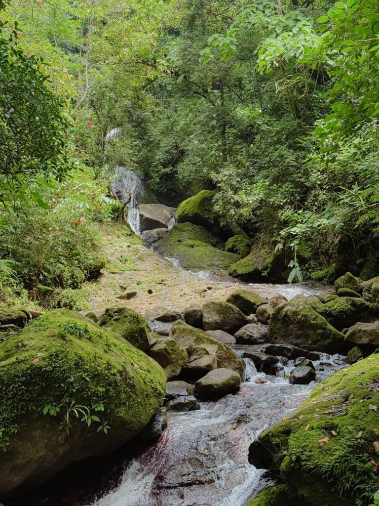
About a quarter mile beyond the painted rock is Chorro el Escondido, a small waterfall that flows beautifully through the forest. It is not large enough to swim in, though you could put your feet in at the base. The setting is genuinely lovely and makes a reasonable turnaround point if you are not up for the full climb to the summit.
The summit and ridge
The summit is unmistakable, marked by a cluster of rocks where hikers gather to take in the view. From here, the crater opens below you and the surrounding mountains stretch out in every direction.
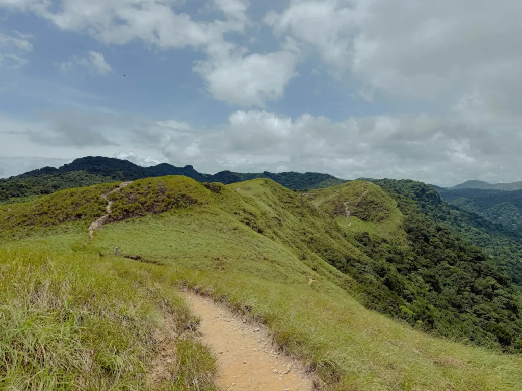
You can continue for about another quarter mile along the ridge beyond the summit. Here the trail narrows to a grassy path with the slopes falling away dramatically on both sides. This is the iconic section of the India Dormida hike, the part that shows up in every photo of Valle de Anton, and it is worth every step of the climb to get there. The obvious endpoint is where the ridge drops steeply into the loop descent. Turn around here.
The trail at a glance
Distance
2.1 miles out-and-back (recommended) / 2.5 miles as a loop
Elevation gain
955 feet
Total time
2 hours
Difficulty
Challenging
Trail type
Out-and-back or loop
Trailhead
Walkable from town center
Entrance fee
$3 - $5 per person
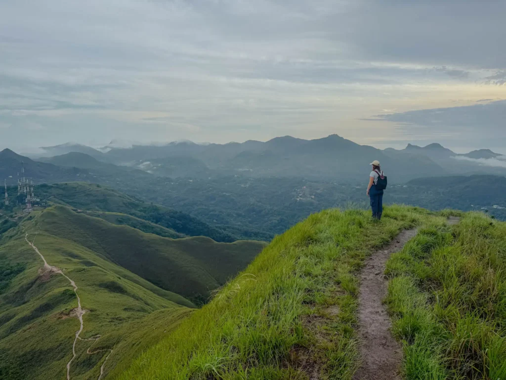
Cerro La Silla is the most visually rewarding trail in the valley for the effort involved, and the one we recommend to visitors who want a genuine hike without the brutality of the India Dormida ascent. The trail is fully exposed from start to finish, which means unobstructed views the entire way, and two summit peaks with panoramas that rank among the best in the region.
If you have time for only one hike in Valle de Anton and you are not chasing the steepest summit, do this one.
Getting to the trailhead
Unlike India Dormida and Cerro Cara Iguana, the La Silla trailhead is not walkable from the town center. Take a local minibus from the central market or grab a taxi. It is a short ride and your driver will know where to go. You pay the entrance fee at the trailhead.
The trail
La Silla is 3 miles total with a walking time of around 1 hour and 40 minutes. It is not a steep climb in the way that India Dormida is. The elevation gain of 1,000 feet is distributed across the full length of the trail with a mix of uphill and downhill sections, which makes the effort feel more manageable than the numbers suggest.
The trail leads to two distinct peaks, both of which give you views into the volcanic crater below and out toward the surrounding mountain ranges. There is something about looking down into the green bowl of the caldera from above that makes the geography of Valle de Anton click. It is one of those views where you understand a place differently afterward.
Because the trail is fully exposed, it catches whatever breeze is available and avoids the heavy canopy humidity you find on more sheltered jungle trails. That said, full exposure also means full sun on a clear morning and no shelter if weather rolls in. Start early.
The trail at a glance
Distance
3 miles
Elevation gain
1,000 feet
Total time
1 hour 40 minutes
Difficulty
Moderate
Trail type
Out-and-back
Trailhead
Minibus or taxi from town center required
Entrance fee
$3 - $5 per person
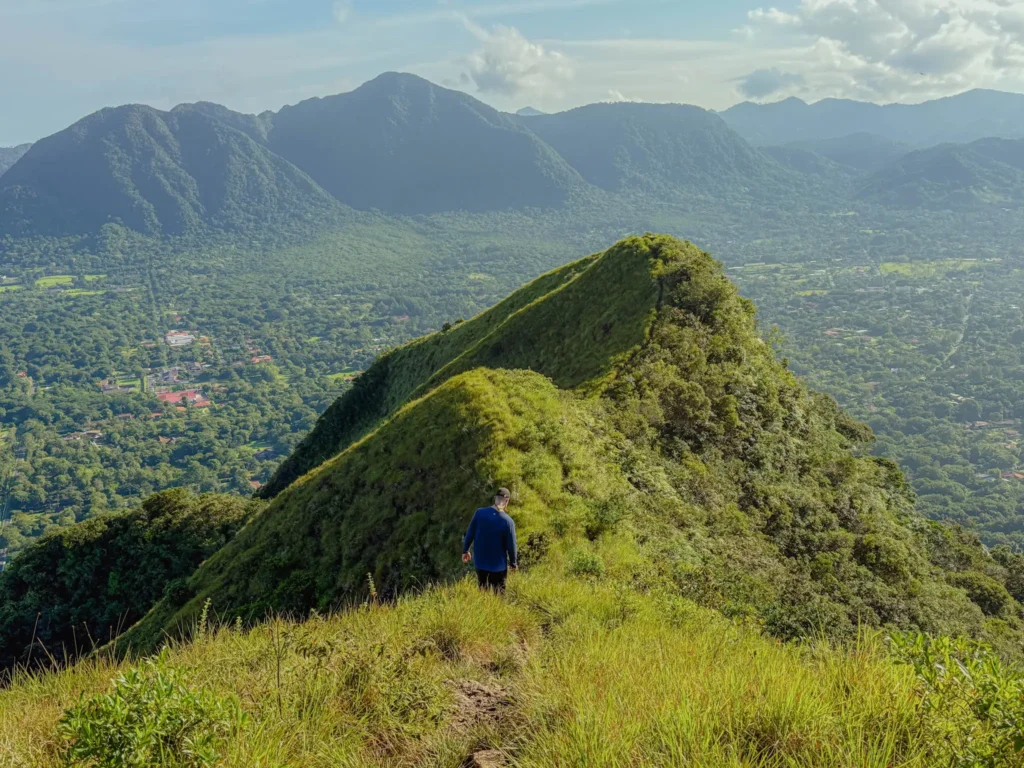
Cerro Cara Iguana is the hardest hike of the three and the one with the most dramatic summit payoff. From the top, you get a full panoramic view of the valley below and the complete silhouette of the India Dormida ridge across from you. This is actually the best vantage point from which to see the sleeping woman in the mountain. From the summit of Cara Iguana, with the full ridge laid out in front of you, the legend finally makes sense.
The name translates to Iguana Face Hill. Locals say the silhouette of the hill, seen from certain angles in town, looks like the head of an iguana. We never spotted it ourselves.
The trail
This is an out-and-back hike with a trailhead walkable from the town center. The full hike is 4 miles with a total elevation gain of 1,850 feet, making it the most demanding trail in the valley by a significant margin. Our walking time was around 2 hours and 30 minutes.
One thing worth knowing before you go: a significant portion of the ascent runs along a road rather than a dedicated trail. This road can be driven with a 4x4 vehicle, and you may see some vehicles on it. For those without a 4x4, you hike the road. It is a less interesting section than the forest trail stretches, but it is straightforward and the summit more than compensates for it.
From the top, the view extends across the full width of the valley. The India Dormida ridge sits directly opposite, and from this angle you finally see the full silhouette that gives the mountain its name. The crater below is lush and green, ringed by cloud forest. On a clear morning, it is spectacular.
The trail at a glance
Distance
4 miles
Elevation gain
1,850 feet
Total time
2 hours and 30 minutes
Difficulty
Strenuous
Trail type
Out-and-back
Trailhead
Walkable from town center
Entrance fee
None
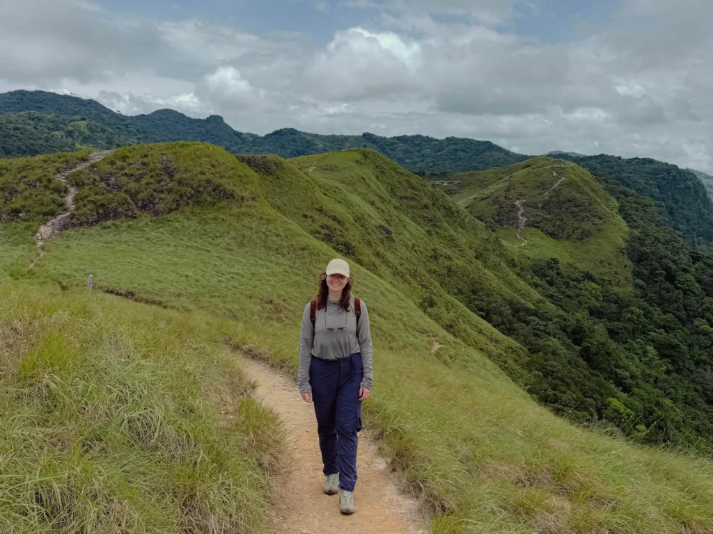
The trails in Valle de Anton sit inside a volcanic crater at around 600 meters elevation. The air is cooler than Panama City but the humidity is real, especially as the morning progresses. By midday, the combination of heat and humidity becomes genuinely heavy. Prepare for both.
Footwear
Wear hiking shoes or trail runners. The trails are not consistently muddy in the way that some jungle hikes are, but the ground is frequently wet, particularly during the rainy season. Sections can be slick on the descent. Avoid regular running or gym shoes. If your trail runners get muddy, that is fine, the trails are not muddy enough to ruin shoes, just enough to require something with grip.
Clothing
Wear lightweight, moisture-wicking clothing. All three hikes have exposed summit sections where you will want to be comfortable in sun and wind. La Silla is fully exposed for the entire hike with no shade at any point.
Trekking poles
We do not hike with trekking poles and managed all three trails without them. That said, poles would have been useful on the India Dormida ascent and descent given the steepness and the wet conditions underfoot. If you use them, bring them for that trail in particular.
What we pack for this
Three items are worth having in your day pack before you hit any of these trails. For the full kit, visit our hiking gear guide →.

Moisture-wicking sun shirt
UPF 50+ protection matters on La Silla, which is fully exposed from start to finish, and on the open summit sections of the other two trails.

Water bottle
Bring at least 1.5L per person. The humidity is deceptive and all three trails involve real climbing.
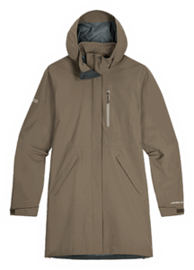
Rain Jacket
Lightweight and packable. The weather in Valle de Anton shifts quickly, especially in the afternoon. You will want it in your pack even on a clear morning.
We completed all three hikes independently without a guide, and all three are navigable without one. The trailheads are signed, the main routes are clear, and downloading the AllTrails routes before you set out covers the gaps where on-trail signage is minimal.
At the base of the India Dormida trailhead, local guides are available for hire for roughly $15 to $25 per person if you want someone to point out flora and fauna along the route. If you speak Spanish, this can add a genuinely interesting layer to the hike, especially if you want to learn the names of the birds and plants you pass.
For other trails in the broader Valle de Anton region beyond these three, such as Cerro Gaital, a guide is more often recommended. Cerro Gaital in particular is known for steep, slippery sections and dense cloud forest where a local hand makes a real difference. Your hotel is the best starting point for getting in touch with a reputable guide.
For the three trails in this guide, you do not need one.
Start in the morning. This is the most important practical piece of advice in this guide.
Temperature and humidity in Valle de Anton rise significantly throughout the day. What feels manageable at 7am becomes genuinely heavy by 11am and uncomfortable by early afternoon. Beyond the physical toll, the cloud cover that builds throughout the day can obscure the views that make these hikes worth doing in the first place.
All three trails have significant summit views as their payoff. A hike that reaches the top in clear morning light is a fundamentally different experience from one that arrives to find the crater socked in with cloud. Aim to be on the trail by 7am and at the summit before 10am if possible.
Dry season vs. rainy season
We did all three trails during the rainy season, which runs from May through November, and they were entirely doable. Just know that afternoon rain is common during these months and the views suffer for it. Some sections of the India Dormida trail can also be slick on the descent in wet conditions.
The dry season, from December through April, is the ideal time for hiking in Valle de Anton. Trails are firmer, summit views are clearer, and the cloud cover is less aggressive. If your trip is flexible, aim for January through March.
For more on planning around Panama's seasons, see our guide to the best time to visit Panama →.
We hiked each trail on a separate day. That is our honest recommendation for most visitors, particularly given the heat and humidity. The trails are more demanding than the mileage suggests, and stacking two of them back-to-back is a real physical undertaking.
That said, combining two trails in a single day is absolutely possible if you are a confident hiker and you start early. We do not recommend attempting all three in one day. The cumulative elevation gain is significant, the heat builds, and by the third summit you will not be enjoying it.
Best combination for iconic hiking: La Silla plus India Dormida. These are the two most recognized trails in the valley. La Silla is the more moderate of the two and makes a good first hike of the day. India Dormida follows once you are warmed up. Leave town by 7am and you can do both comfortably.
Best combination for views: La Silla plus Cerro Cara Iguana. If you are choosing based purely on summit payoff, these two deliver the best panoramas. Cerro Cara Iguana is the harder of the two, so do La Silla first in the cooler morning, then tackle Cara Iguana before the midday heat sets in.
Our pick for a single trail: If you only have time for one hike in Valle de Anton, our recommendation depends on what you are after.
If you want a more challenging hike in Panama, look into hiking up Volcan Baru, the highest point of Panama, in the Boquete region.
Quick answers to the most common questions about hiking in Valle de Anton.
Planning the rest of your time in Valle de Anton?
Hot springs, waterfall hikes, the Sunday market, and where to stay in the crater.
The Valle de Anton guide →