
Part of the New Zealand Travel Guide
← Back to New ZealandThe top of the South Island is where the ferry from Wellington arrives, and it covers three very different areas that share a coastline. Marlborough, in the northeast, is New Zealand's largest wine region and the source of most of the sauvignon blanc that put the country on the map. Nelson and Tasman, in the northwest, hold Abel Tasman National Park and the sunniest weather in the country. The West Coast runs the entire western edge of the island south from there.
The West Coast is the part most itineraries cut when time is short, and it is also the most distinctive driving in New Zealand. It is one of the wettest inhabited places on earth, receiving several meters of rain a year, which is exactly why the rainforest grows the way it does and why Franz Josef and Fox Glacier descend far closer to sea level than glaciers at this latitude normally would.
Grouping these three areas together makes sense for how you would actually travel them, moving from Picton west and then south (or in the opposite direction), rather than because they feel alike. Below is how many days each one needs, where to stay along the way, and how to decide whether the West Coast belongs in your itinerary at all.
Quick Resources to Plan Your Trip to New Zealand
Things To Do in Abel Tasman National Park: Day Walks, Kayaking, and More
An itinerary to explore the things to do in Abel Tasman National Park throughout a weekend, by hiking, kayaking, sun bathing, or all three.
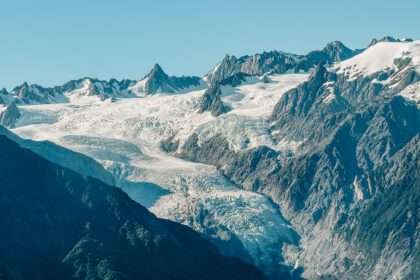
The Best West Coast of New Zealand Road Trip
An itinerary of the things to do along the West Coast of New Zealand and how to best enjoy the amazing views of the underrated region.