New Zealand is an amazing place to visit for those who love the outdoors. And while the Great Walks of New Zealand are all multi-day hikes, not everyone has the desire, time, or propensity to spend a few days on the trail. So here is a list of the best day hikes of New Zealand, all of which are quite varied in location, length, and difficulty to make sure that you are seeing the extensive beauty that New Zealand has to offer. There is no significance to the order of this list.
South Island
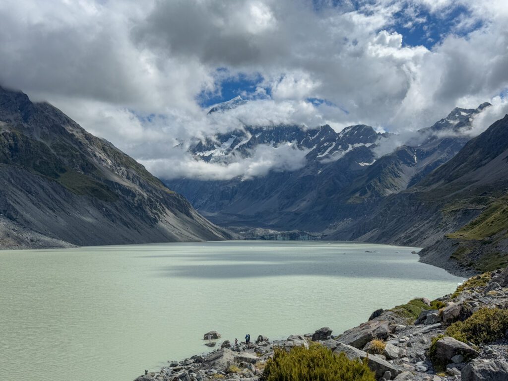
The Hooker Valley Track
...for an easy hike with beautiful views
Distance:
6.8 miles (10.9 kilometers)
Elev. Gain
646 ft (197 m)
Time:
Less than 3 hours
Difficulty:
Medium
The trail is relatively flat and is mostly on a boardwalk as you make your way to Hooker Lake, making it one of the most accessible best day hikes of New Zealand. At the viewpoint, you will see a lake formed by a glacier that still flows into it. You will also have the chance to see Aoraki / Mount Cook towering above if the sky is clear.
South Island
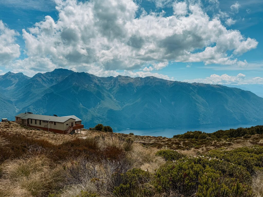
The Kepler Track: Brod Bay to Luxmore Hut
...for a sample of a Great Walk
Distance:
9.8 miles (15.8 kilometers)
Elev. Gain
2,789 ft (850 m)
Time:
Less than 3 hours
Difficulty:
Hard
The Kepler Track is typically a 4-day hike and one of the Great Walks of New Zealand. However, the first part of the hike can be completed as a round-trip day hike. This hike goes up through the forest to above the tree line where you will have beautiful views of the surrounding mountains and nature. The great thing about this hike is that the trailhead can be accessed by boat that departs from the town center of Te Anau.
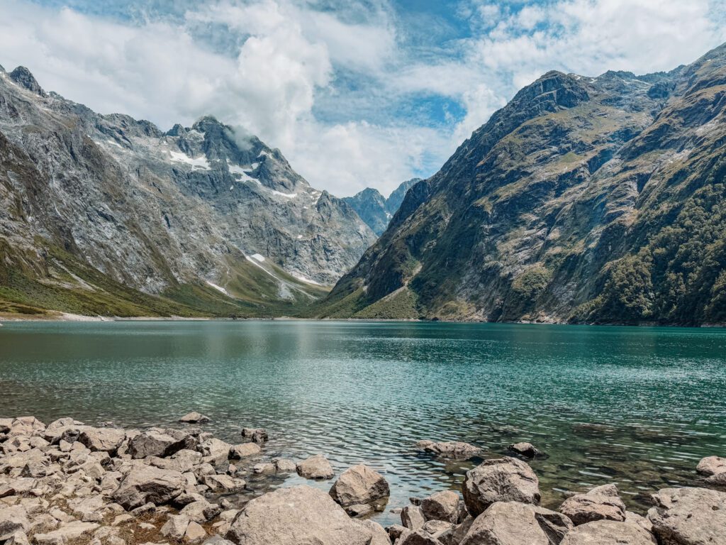
South Island
Lake Marian Track
...to reach an alpine lake
Distance:
3.8 miles (6.1 kilometers)
Elev. Gain
1,312 ft (400 m)
Time:
3-4 hours
Difficulty:
Strenuous
Lake Marian is a beautiful alpine lake. This hike is challenging and includes a steady climb over rocks and roots. You need to wear good hiking boots and avoid doing this hike when the ground could be wet because the track may be slippery. With this challenging hike, you will be rewarded with beautiful views of an alpine lake nestled within the mountains.
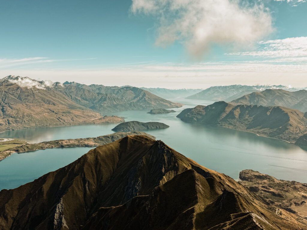
South Island
Roy's Peak Track
...for a challenge that a lot of people talk about
Distance:
9.9 miles (15.9 kilometers)
Elev. Gain
4,213 ft (1,284 m)
Time:
5-6 hours
Difficulty:
Hard
For those who are avid hikers or want an athletic challenge, Roys Peak Summit is one of the most popular day hikes of New Zealand. The walk itself is not the most interesting and is quite intense, walking steeply uphill for the entire hike. However, at the peak, you will get beautiful views of the valley and lakes below.
The Blueprint Travelers Hiking Staples


South Island
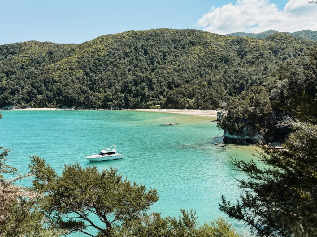
Abel Tasman Track: Anchorage to Marahau
...for access to secluded beaches
Distance:
7.2 miles (11.6 kilometers)
Elev. Gain
1,453 ft (443 m)
Time:
4.5 – 5.5 hours
Difficulty:
Medium
This one-way hike is initially accessed by water taxi from the main town of Marahau. Throughout the walk you will have the opportunity to hike down to various viewpoints and bays, giving yourself access to isolated beaches to take advantage of the beautiful and clear turquoise water. The full track is one of the Great Walks of New Zealand so you can also extend your journey to be a multiday hike and go from hut to hut.
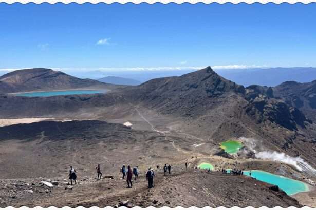
North Island
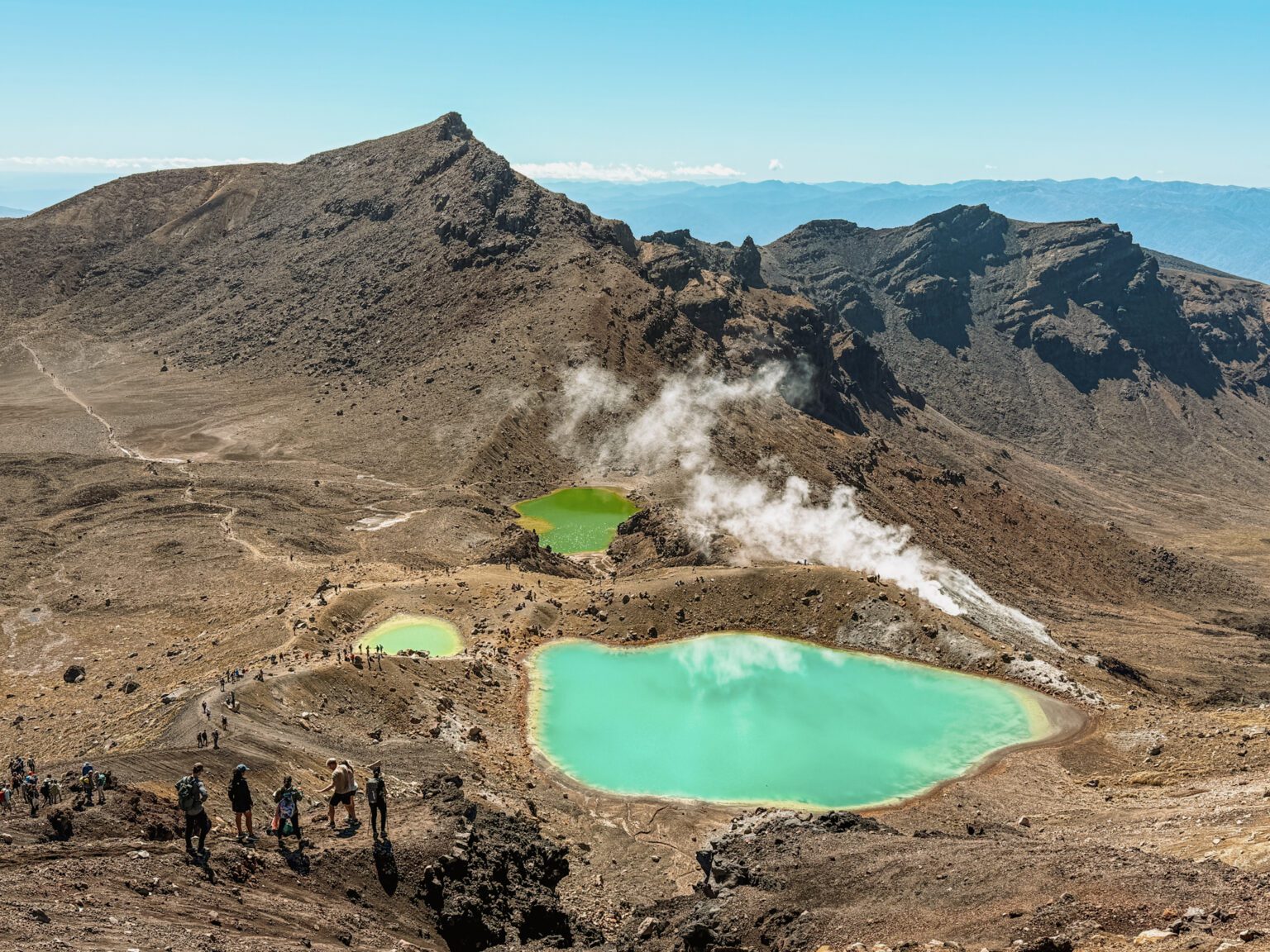
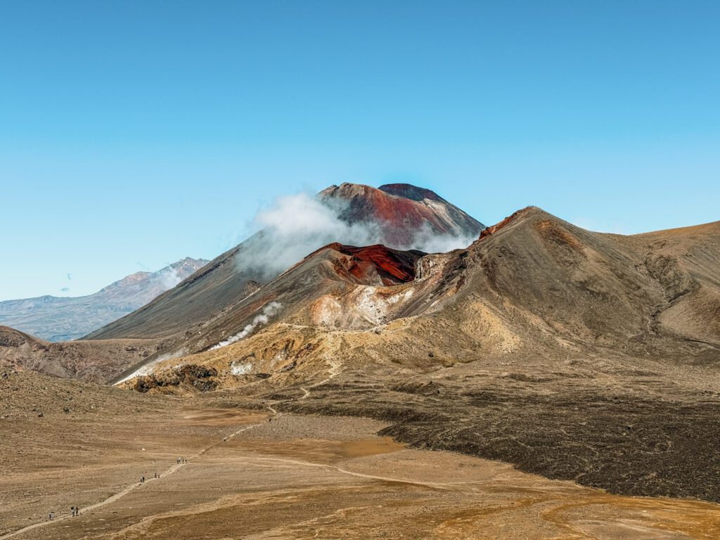
Tongariro Alpine Crossing
...for one of the best day hikes of New Zealand and the world
Distance:
12.4 miles (20 kilometers)
Elev. Gain
2,799 ft (853 m)
Time:
6-8 hours
Difficulty:
Hard
The Tongariro Crossing is considered one of the best hikes of New Zealand, with some even saying the world, and is incredibly popular. As a one-way hike, it is a challenging trek that goes up and over an impressive volcanic landscape. You will be driven to the start of the hike with a shuttle service and end near the carpark. The terrain is ever changing and keeps the entire walk interesting, starting with volcanic terrain with geothermal properties and views of the Lord of the Rings Mount Doom before transforming to tropical forests at the end.
North Island
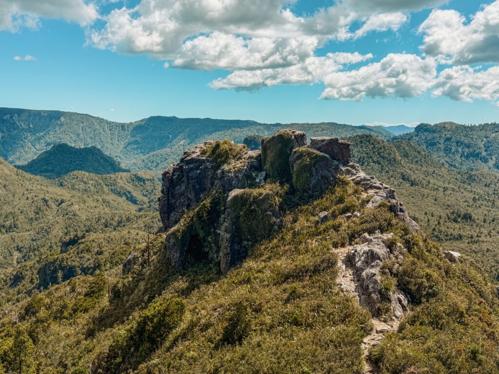
Pinnacles Track: Kauaeranga Kauri Trail
..for a potential introduction to one of the multi-day hikes of New Zealand
Distance:
8.6 miles (13.8 kilometers)
Elev. Gain
2,546 ft (776 m)
Time:
5-7 hours
Difficulty:
Hard
The Kauaeranga Kauri Trail is a challenging day hike that goes to the Pinnacles summit. There is also a hut near the summit so, while this hike is doable as a day hike, the best way to experience it is to spend the night at the Pinnacles Hut. The beginning of the walk is relatively straight forward, hiking uphill through the forest. To get to the peak past the hut, you will have to go up a lot of stairs fully exposed and climb some metal ladders.
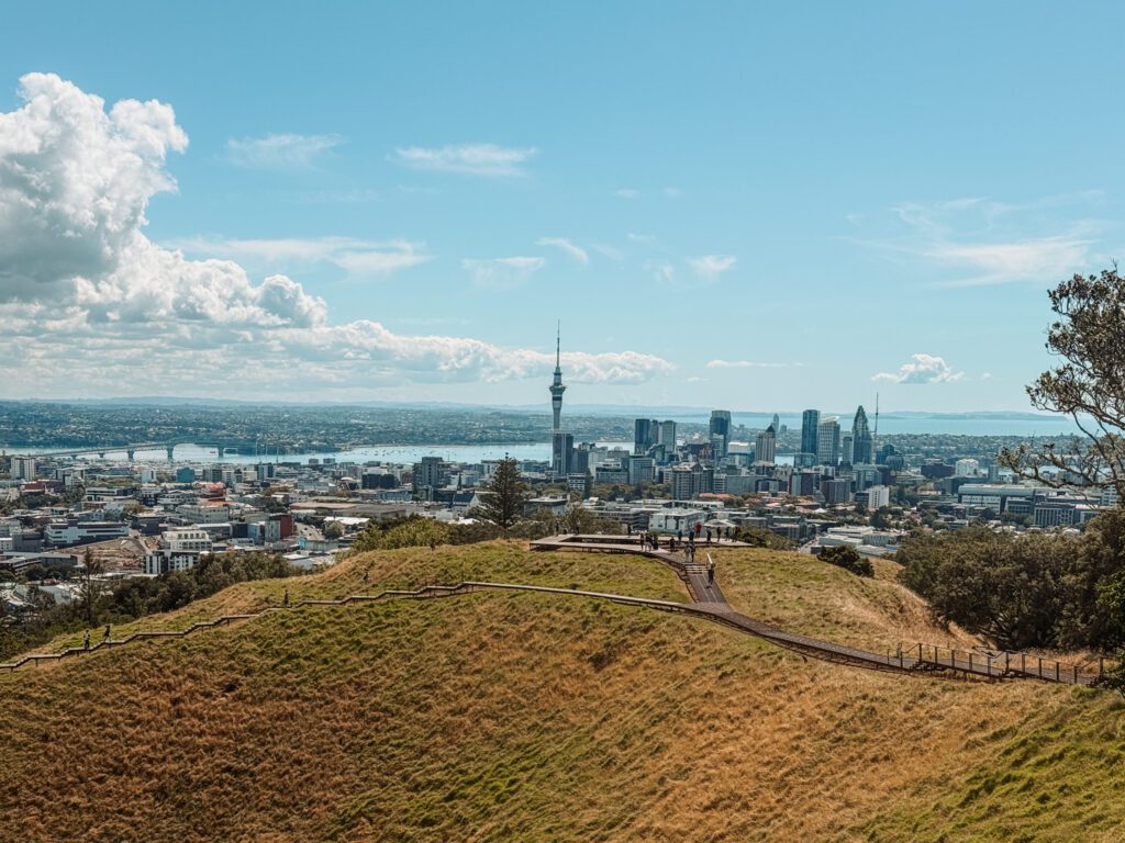
North Island
Auckland's Coast to Coast Walk
...for an urban walking trail...
Distance:
10.3 miles (16.6 kilometers)
Elev. Gain
1,457 ft (444 m)
Time:
5-7 hours
Difficulty:
Medium
Auckland is located at one of the most narrow points of all of New Zealand. In fact, there is a coast to coast walk that goes from one side of the island to the other, meaning you can traverse across the country in less than a day. This walk also passes by a few of the most popular viewpoints and museums in the city which makes it a great way to see some of the best that Auckland has to offer.