Co-founder and editor-in-chief of Blueprint Travelers. She has traveled every destination on this site herself and writes the guides from the ground.
- Co-Founder & Editor-in-Chief
14 Min Read
This post may contain affiliate links. When you make a purchase using one of these affiliate links, we get paid a small commission at no extra cost to you.
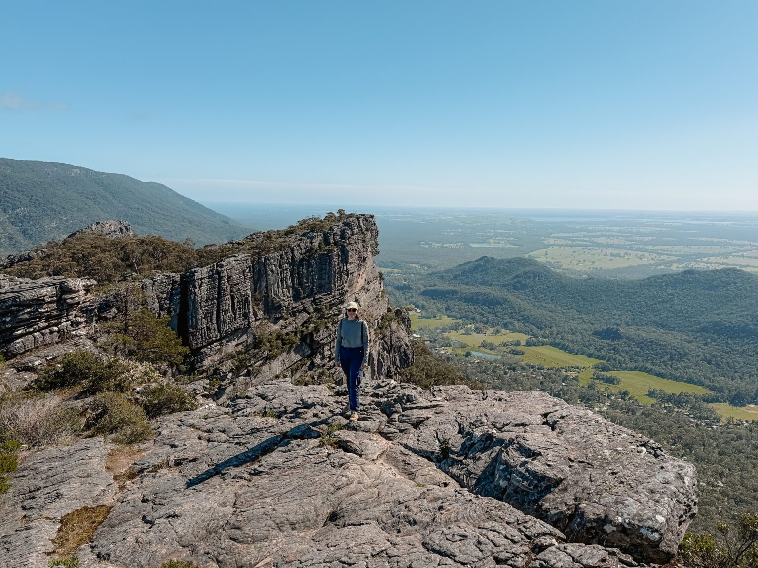
The Pinnacle hike of Grampians National Park overlooking the valley below
Grampians National Park is one of over 650 national parks in Australia. Located between Adelaide and Melbourne, this is the perfect place to stop when traveling between the two cities to hike, learn about some aboriginal culture, and see the wildlife of this uniquely mountainous region. This guide is full of the various attractions in Grampians National Park. The guide is intended for those who are interested in spending 1-2 days in the park and have never visited the area before. For those who have more time, are experienced campers/hikers, or know their way around the national park, this guide will feel rudimentary for you. If you are looking for the ultimate hike in the Grampians, look into the 13-day Peaks Trail (or part of it) which goes through the whole park from north to south.
How Are the Attractions in Grampians National Park Organized?
There are three sections to the national park: the north, central, and south.
Northern Grampians: This area has most of the aboriginal rock art of the park. It also has some harder hikes that include scrambles and climbs.
Central Grampians: This is the area that is most popular to visit (and what this guide mostly discusses). Halls Gap, the main town within the national park is located in the central Grampians area and is a strong hub from which you can do many different activities, including hiking, fishing, camping, touring by car, and more.
Southern Grampians: This area is more rugged and less visited than the other two. The highest peak of the park is located here and is perfect for isolated camping, hiking, and exploring.
When visiting the national park, this guide will give you an idea of the most popular attractions in Grampians National Park. However, you will want to visit the local visitor center or the official Grampians park page to learn about some alternative options for your time in this area.
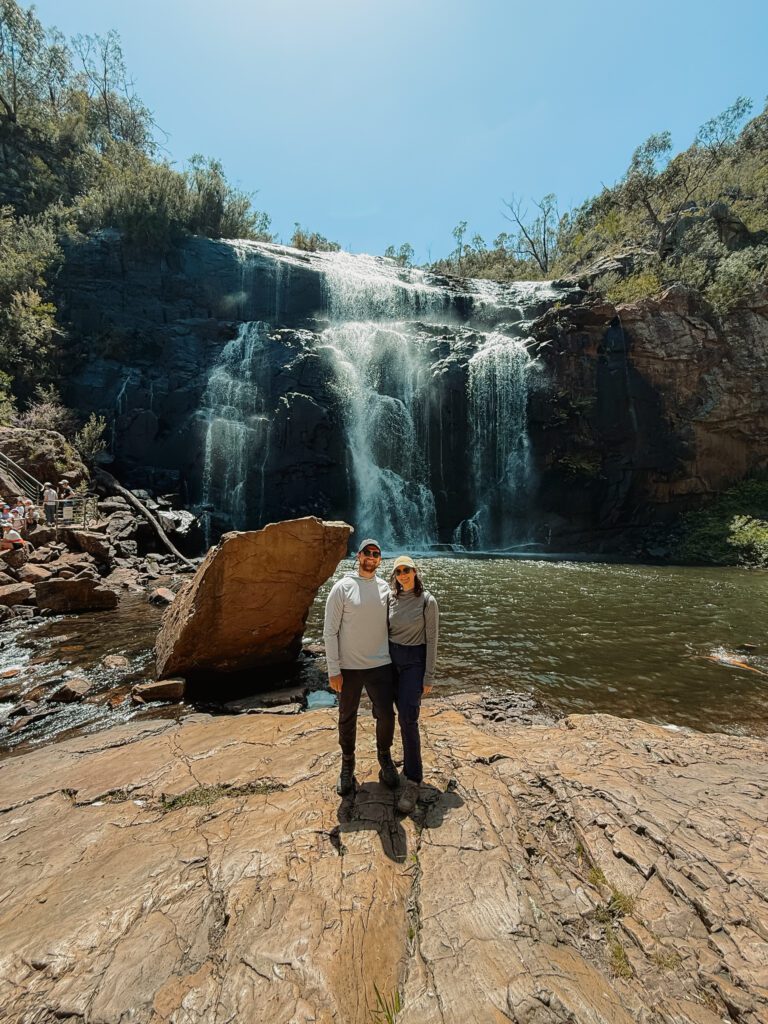
Mackenzie Falls, one of the many falls that can be visited during your time in Grampians National Park
When To Visit Grampians National Park
Landscapes in Australia can be strongly affected by bush (forest) fires. These fires may occur naturally or may be enacted in a preventative measure. Either way, they are part of the natural regenerative cycle that nature requires by burning off dead and dry plants and providing fertilization to larger fauna. Those that are performed by the park services are controlled fires to help prevent larger disasters from happening. The ones that occur naturally are due to dry circumstances and may get out of control. It is important to research when controlled burns will take place, understand the risk of wildfires when you are looking to visit, and to notify park services if you are camping or hiking in different areas of the park so they can best keep you safe.
Why Visit the Grampians? Where Should You Visit the Park From?
The Grampians are the perfect place to stop when traveling between Adelaide and Melbourne. It is a nice midpoint between the two cities, especially when traveling along the inland route. It is also a nice destination to add onto your trip along the Great Ocean Road, creating a beautiful loop through Victoria, Australia to see a variety of iconic landscapes. You can read more about the Great Ocean Road from Melbourne here.
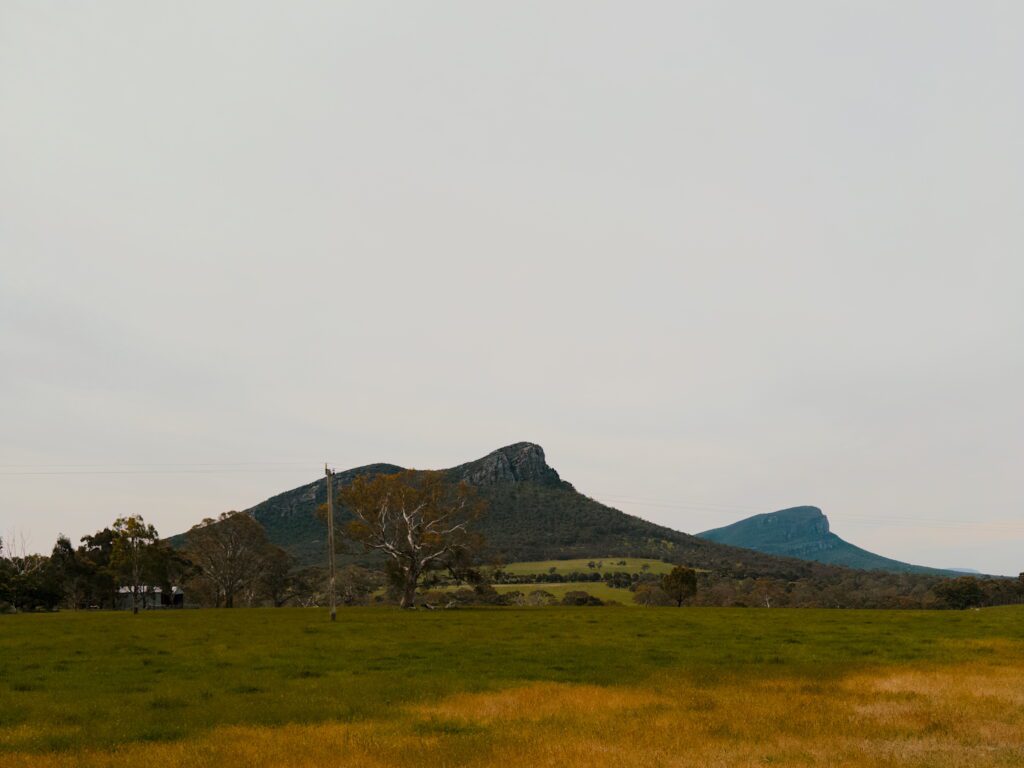
The initial view of the Grampians mountains when coming from the Great Ocean Road
Best Time of Year to Visit
The spring (September – November) and fall (March – May) are the best times to visit because they bring in fewer tourists while having temperate weather (65°F/18°C). The summers are great for spending time in waterfalls and swimming holes throughout the park because of the heat (80°F/27°C) and the winters are best for those who want to hike with the fewest number of tourists in chillier weather (50°F/10°C).
It should also be noted that the park tends to be busier during the holiday weekends of Melbourne or Adelaide so keep that in mind when planning your trip. Finally, always check if bushfires have shut down the park or are at risk of hindering your plans in Grampians.
How Many Days Do You Need to Visit Grampians National Park?
You should plan to spend at least 1 full day in Grampians National Park and stay in or near the park for the evening before and after that full day to maximize your time exploring the nature and culture here. With that full day, you can do the hikes and vistas discussed below. If you do not want to feel rushed, plan on spending an additional day in the park and continue to add more days to your itinerary as you want to explore different parts or do different activities throughout your time here.
Where to Stay to See the Attractions in Grampians National Park
The main town within Grampians National Park is Halls Gap. It has sufficient infrastructure for people who are thinking of camping, using campervans, or staying in hotel/motel/hostel accommodations. Halls Gap also has convenience stores and restaurants that can help support your stay.
If Halls Gap is fully booked (which could happen on holiday weekends or in the summer), then consider finding accommodations in Stawell. It is located an easy 30-40 minutes away from Halls Gap and has larger grocery stores and accommodations that can fully support your stay.
Grampians National Park has unique landscapes that make it perfect for hiking to explore nature. These hikes are not necessarily long or the most challenging but provide a nice way to get to unique viewpoints, watering holes, creeks, waterfalls, etc. Below are some of the most popular ones.
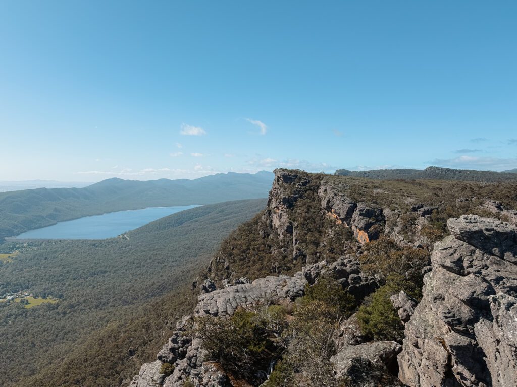
The Pinnacle
The most popular hike and viewpoint of the park is the Pinnacle. From the peak, you can get a beautiful view of the Grampians and the valley with Halls Gap below. There are a few different paths that you can take to reach this vista, making it easy to access even from Halls Gap itself. That being said, the trails can get busier throughout the day so try to do this hike as early as possible.
The view from the Pinnacles viewpoint of the hike
From Halls Gap
Distance:
5.4 miles (8.7 kilometers)
Elev. Gain
1,627 ft (496 m)
Time:
3 – 4 hours
Difficulty:
Hard
This trail uniquely departs directly from Halls Gap so if you are staying in town, you can get onto the hike directly from your accommodations.
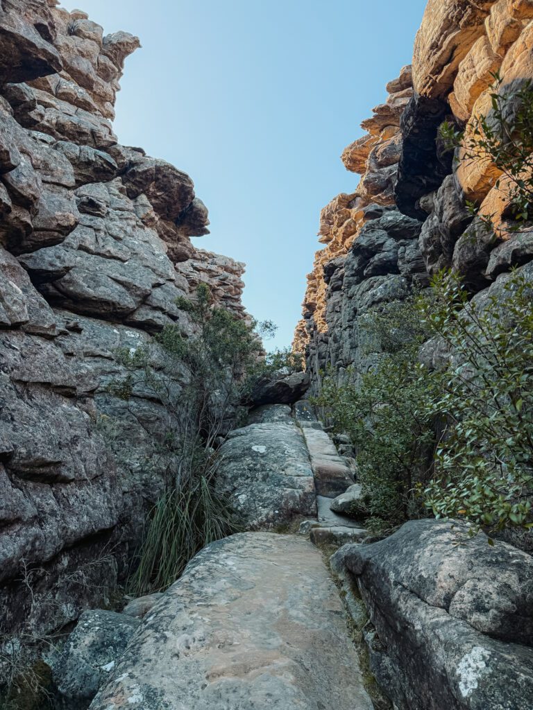
Another option is to go through the Grand Canyon of Grampians National Park to reach the Pinnacle. With this option, you will get to go through a unique canyon landscape, keeping you cool and in the shade while challenging you through some fun rock formations. This route takes less than 2 hours and is around 3.9 kilometers (2.5 miles) long. You will have to drive to a different car park (the Wonderland Carpark) outside of Halls Gap to get to the trailhead.
The canyon through which you hike on the Pinnacle hike through the Grand Canyon
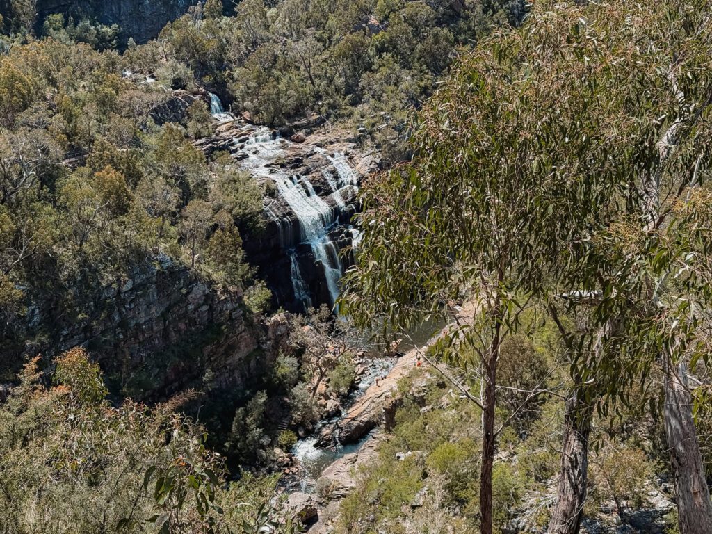
Mackenzie Falls
Distance:
0.8 miles (1.3 kilometers)
Elev. Gain
223 ft (68 m)
Time:
Less than 1 hour
Difficulty:
Moderate
MacKenzie Falls is a popular and accessible destination within Grampians National Park to see a waterfall. On this relatively flat path, you can access an overlook from which you can see the falls. If you want to get closer, you can take a different path down and get to the base of the waterfalls. This pathway has a lot of stairs and can get pretty crowded but you can find space at the base of the waterfall to sit, relax, and take in the views/sounds of nature.
The pool into which the waterfalls flow at MacKenzie Falls
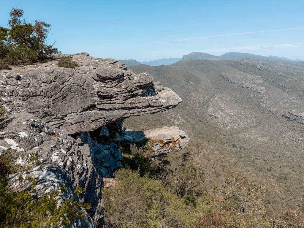
The Balconies
Distance:
1.3 miles (2.1 kilometers)
Elev. Gain
193 ft (59 m)
Time:
Less than 1 hour
Difficulty:
Easy
The Balconies is more of a viewpoint than a hike, although you will still have to walk about 2 kilometers total (1.2 miles) to experience them. The Balconies lookout overlooks a large valley below, providing beautiful views of the overall landscape. For those who do not want to walk, you can visit the Reed Lookout directly from the carpark which gives you a view of the valley below.
The view from the Balconies overlooking the national park
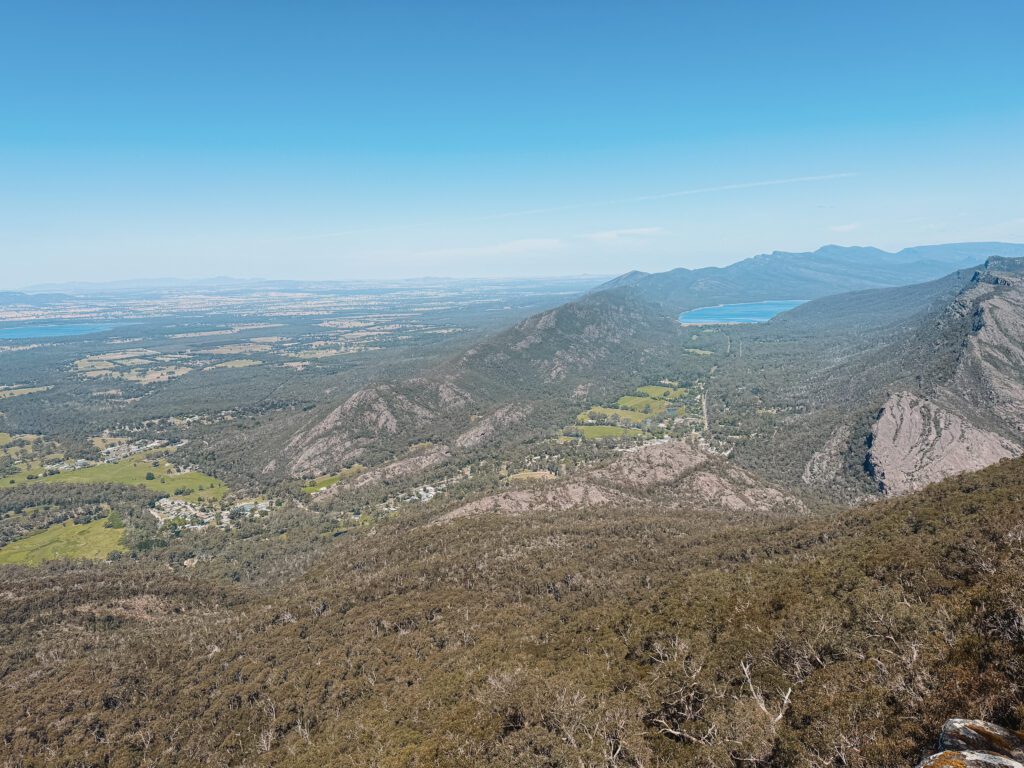
The Boroka Lookout is a viewpoint directly off of a carpark. You get a beautiful view of the town of Halls Gap and the reservoir below. It is a great place to culminate your time in the park and see the beautiful terrain you’ve traversed throughout your day.
The view from Boroka Lookout overlooking the valley below
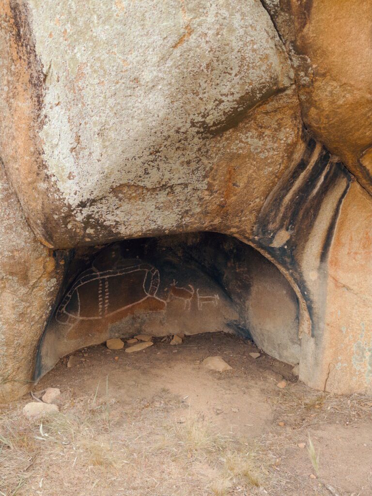
Grampians National Park, originally named Gariwerd by the local aboriginal people, was inhabited by the Jadawadjali and Djab Wurrung peoples for over 30,000 years. You can learn more about the original owners at the Brambuk Information Centre (it is being renovated in 2024 but there is still information about the indigenous people of this area).
Today, there are 5 locations with rock art attractions in Grampians National Park that are available to be seen by visitors. These are protected by overhangs and have fences to prevent people from defacing the ancient artwork. Bunjil’s Shelter, near Stawell, is considered the most important one to visit (and it’s the easiest to get to from Halls Gap), but you can also discover Manja Shelter and Billimina Shelter in the west and Ngamadjidj Shelter and Gulgurn Manja Shelter to the north. These locations have placards that explain the significance of the artwork and importance of each site, enriching your experience in this national park.
The aboriginal artwork within Grampians National Park at the Bunjil’s Shelter
A Sample 48 Hour Itinerary to Visit the Main Attractions in Grampians National Park
Morning
Afternoon
Day 1
Visit the Grampians National Park visitor center
Day 2
Hike the Pinnacle
Hike down to Mackenzie Falls and eat lunch while looking at the waterfall
Walk to the Balconies and take in the views at the Boroka Lookout
Day 3
Walk to the Bunjil’s Shelter to see ancient Aboriginal artwork
What To do Before or After this Weekend in Grampians National Park