The different transportation options in Santiago to best visit, experience, and navigate the capital city of Chile and the surrounding area.
6 Min Read
This post may contain affiliate links. When you make a purchase using one of these affiliate links, we get paid a small commission at no extra cost to you.
After having previously navigated through Buenos Aires, we were confident in our ability to use the public transportation in major cities in South America. You can read more about that experience here. I found that the transportation options in Santiago were very similar to those in Buenos Aires, making it a simple learning curve.
Google maps is your best friend. It is accurate with showing bus and metro information to get you from one destination to another. (Maybe not the timing of the transportation but definitely for the directions.) If you do not have service in the city, look up the directions beforehand. You should also always download the map of the region so you can look up driving directions at the minimum to get between places.
Below are the different options that are available to you when exploring Santiago.
Walking Around Neighborhoods
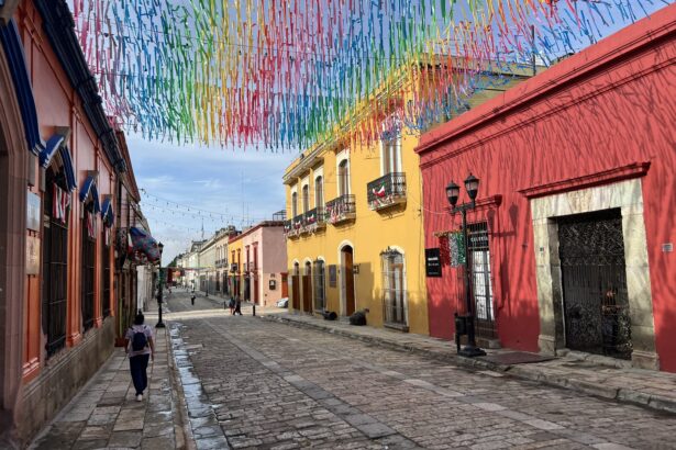
Walking through the historical center of Santiago, Chile
The city is large and sprawling and walking is truly only viable within a neighborhood or two and (When it comes to safety, it is important to be aware of where you are walking and your surroundings. If you are aware, stay in tourist and commercial neighborhoods, and don’t walk alone through areas that seem abandoned, you will be okay in the city!) It is the best way to feel the energy of the city, see the shops and sights, and experience the city. However, consider other means of transportation when getting between neighborhoods.
Using Public Transportation to Navigate Santiago, Chile
The main transportation option in Santiago is public transportation. Using the subway or buses is the most economical and sustainable way to navigate large distances throughout the city. Santiago, Chile has an extensive transportation system, including buses and a subway system. Both of these are safe and great ways to get between neighborhoods or traveling in the evenings.
To use public transportation, you need to obtain a “Red” card. You can buy them at subway stations with cash only. The card costs a flat fee but you don’t have to pay any additional fees to load money on the card. Overall, rides with the “Red” card will be a about 50 cents!
The Subway
Santiago's subway system
The subway is a fast and efficient way to navigate Santiago. We never waited more than a few minutes for a train. If Google Maps shows the subway as an option to get between two places, use it!
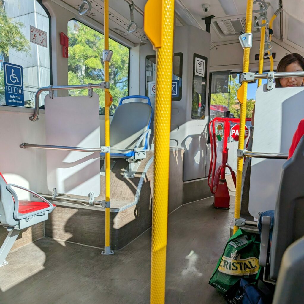
The Buses
The network of buses is large. Chances are, there are a number of bus stops around your hotel or short-term apartments. Use Google Maps to determine the best route. The bus stops are indicated by a bench and overhang or a number on a pole. There are a couple of things you need to know to best use the buses:
A typical bus in Santiago, Chile
You can see what bus is arriving by the number displayed on the top of the bus.
Once the bus stops, get on the bus as quickly as possible because the bus driver will be itching to leave the stop. You will scan your card against the card reader until it gives you the green light and go through the turnstile to find a seat or stand if the bus is full.
To get off the bus, make your way towards the middle or back doors and press the button on the pole by the doors. The bus driver will not stop unless you press the button to indicate that you want to get off at the next stop.
What About Ubers?
The city has a lot of Ubers and it is a really easy way to get around, especially if you are nervous about getting from place to place. You will not have to wait very long for a car and it is similar in price to a taxi. While this is the most expensive way to navigate Santiago (from this list at least), it will not break the bank.
Disclaimer: We have not used the following forms of transportation options in Santiago yet but wanted to share them for your use
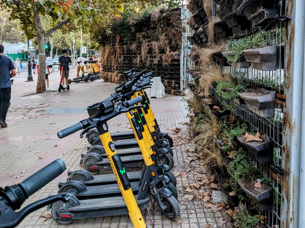
Bikes! Scooters! What More Could You Want?
Scooters at a park in Santiago, Chile
You may see some orange bikes around the city. These are the local shared bike service. However, you will need to download the application (linked here) and create an account. You will need data to use the app to take out a bike.
In addition to the bikes, there are some areas that are equipped with “Lime” and other brands of scooters. You will also need applications to use these but they could be nice way to explore the park areas of the city.