Blueprint Travelers - Travel Site
  • Destinations

    Latin America

    Argentina
    Bolivia
    Brazil
    Chile
    Colombia
    Ecuador
    Mexico
    Paraguay
    Peru
    Uruguay

    Oceania

    Australia
    New Zealand
    All Destinations
  • Resources
    • Itineraries
  • Who We Are
    • About Us
    • Work With Us
    • Our Travel Journal
  • Contact Us
Need help planning your next vacation? Reach out to us and we can help you with your future adventure
Font ResizerAa
Blueprint Travelers - Travel SiteBlueprint Travelers - Travel Site
Search your destination or topic...
  • Latin America
    • Argentina
    • Bolivia
    • Brazil
    • Chile
    • Colombia
    • Ecuador
    • Mexico
    • Paraguay
    • Peru
  • Oceania
    • Australia
    • New Zealand
  • Resources
    • All Our Itineraries
    • Contact Us
  • About Us
    • Who We Are
    • Work With Us
    • Our Travel Journal
Follow US
Blueprint Travelers - Travel Site > Argentina > The 5 Easiest Ways to Navigate Buenos Aires
ArgentinaBuenos AiresLatin America

The 5 Easiest Ways to Navigate Buenos Aires

The different modes of transportation to best visit, experience, and navigate Buenos Aires, the capital city of Argentina.

Last updated: June 3, 2025
8 Min Read
This post may contain affiliate links. When you make a purchase using one of these affiliate links, we get paid a small commission at no extra cost to you.
Buses and cars flying through an intersection in Buenos Aires, Argentina
Jump to
Walking Around the CityUsing Public Transportation to Navigate Buenos AiresFree Bikes! No Way!Taking a Taxi to Navigate Buenos AiresWhat About Ubers?

Through our time trying to navigate Buenos Aires, I have felt that getting around has been an organized chaos through an interconnected web. From getting from the airport to our short-term apartment to just trying to cross the street, there is some urban skill and a little luck required to get around the city. And honestly, Google maps is your best friend. We have been able to navigate Buenos Aires by walking or taking public transportation. This included getting from the airport. We are planning to use a taxi or Uber to return to the airport when we decide to leave but we wanted to show you the plethora of options that you have to explore.

Walking Around the City

Street in San Telmo, Buenos Aires, Argentina with shops with green awnings.
San Telmo, Buenos Aires, Argentina

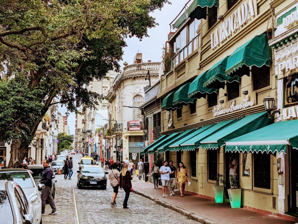
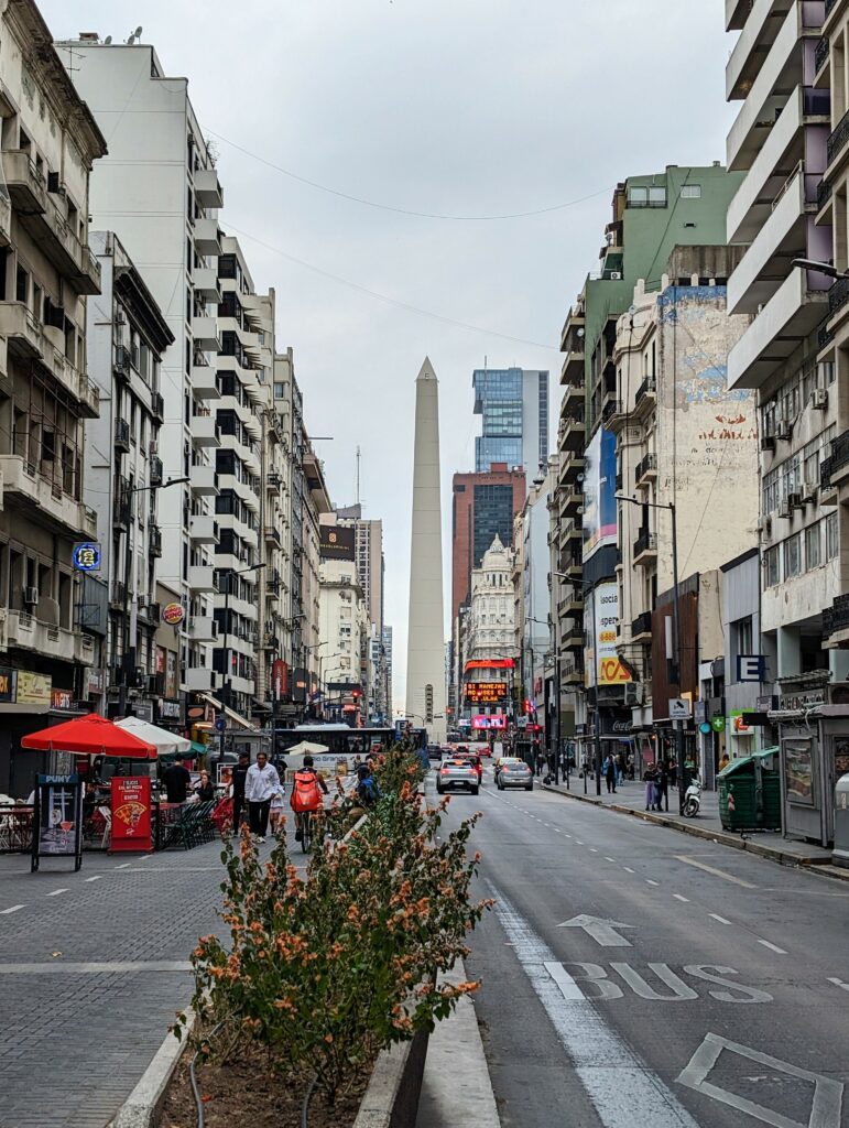
The city is large and sprawling and walking is truly only viable within a neighborhood or two. It is the best way to feel the energy of the city, see the shops and sights, and experience the city. However, consider other means of transportation when getting between neighborhoods.

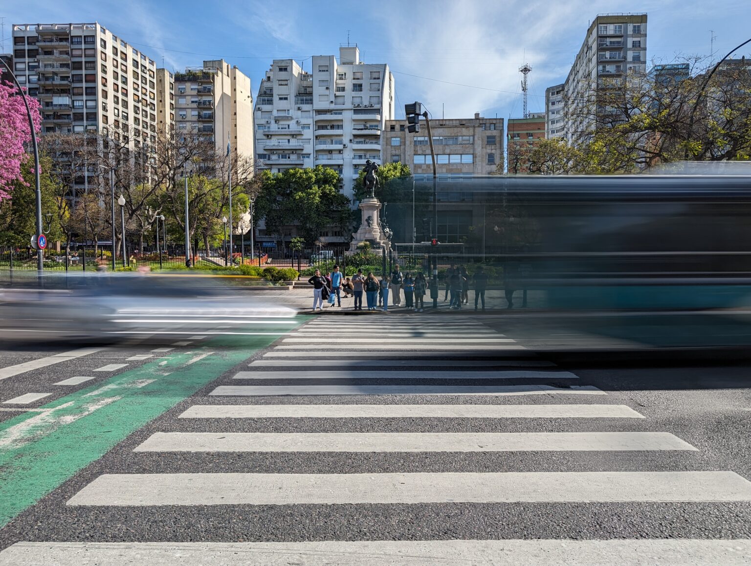
When it comes to the hierarchy on the road, the buses are kings, the cars come next, then come the bikes, and finally there are the pedestrians. Do not expect any vehicles to yield for you to cross the street and make sure to look both ways on one-ways for any bikes. Cars and buses travel fast and brake hard, but it won’t be hard enough to save you, so make sure to keep your head on a swivel!

Another easy way to walk around the city and see the sites is through walking tours of different neighborhoods. You can read our experience with the ones in Buenos Aires here.

Using Public Transportation to Navigate Buenos Aires

View down Avenida Corrientes of the Oculus, a main thoroughfare to navigate Buenos Aires, Argentina
Avenida Corrientes, Buenos Aires, Argentina

Public transportation is the most economical way to navigate large distances throughout the city. Buenos Aires is incredibly proud of the transportation system that they have built in the city. And rightly so! There are so many bus lines that you will most likely get from point A to point B with minimal walking and few transfers.

To use public transportation, you need to obtain a “Sube” card. Many short-term apartments provide the card for you but you can buy them at the airport, subway stations or different kiosks throughout the city (JEVI or Lottery Agencies for example). The card costs a flat fee but you don’t have to pay any additional fees to load money on the card. Overall, rides with the sube card will be a few cents!

We used a combination of the subway and buses to navigate Buenos Aires and even from the airport. When you first land, go to the tourist information desk after customs and they can explain to you how to get the Sube card within the airport and get into the city with ease.

El Subte (The Subway)

Subte entrance to navigate Buenos Aires, Argentina
Subte entrance, Buenos Aires, Argentina

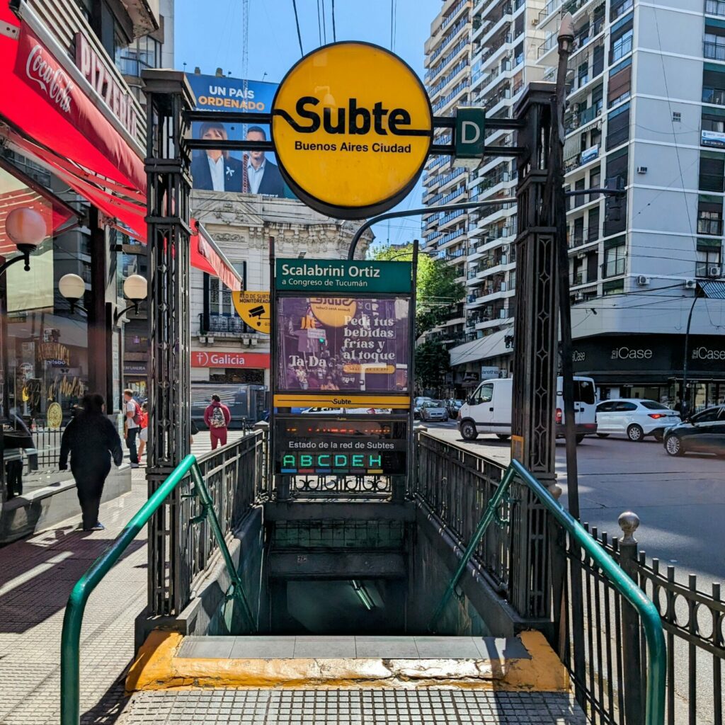
“El Subte” (the subway) is a fast and efficient way to navigate Buenos Aires but it does not have the most extensive network. If Google Maps shows the subway as an option to get between two places, use it!
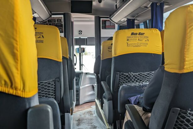
Los Colectivos

The network of buses (Colectivos) is large. Chances are, there are a number of bus stops around your hotel or short-term apartments. Use Google Maps to determine the best route. The bus stops are indicated by a bench and overhang or a number on a pole. There are a couple of things you need to know to best use the colectivos:

Interior of bus or colectivo with brown seats to navigate Buenos Aires
Buenos Aires colectivo interior
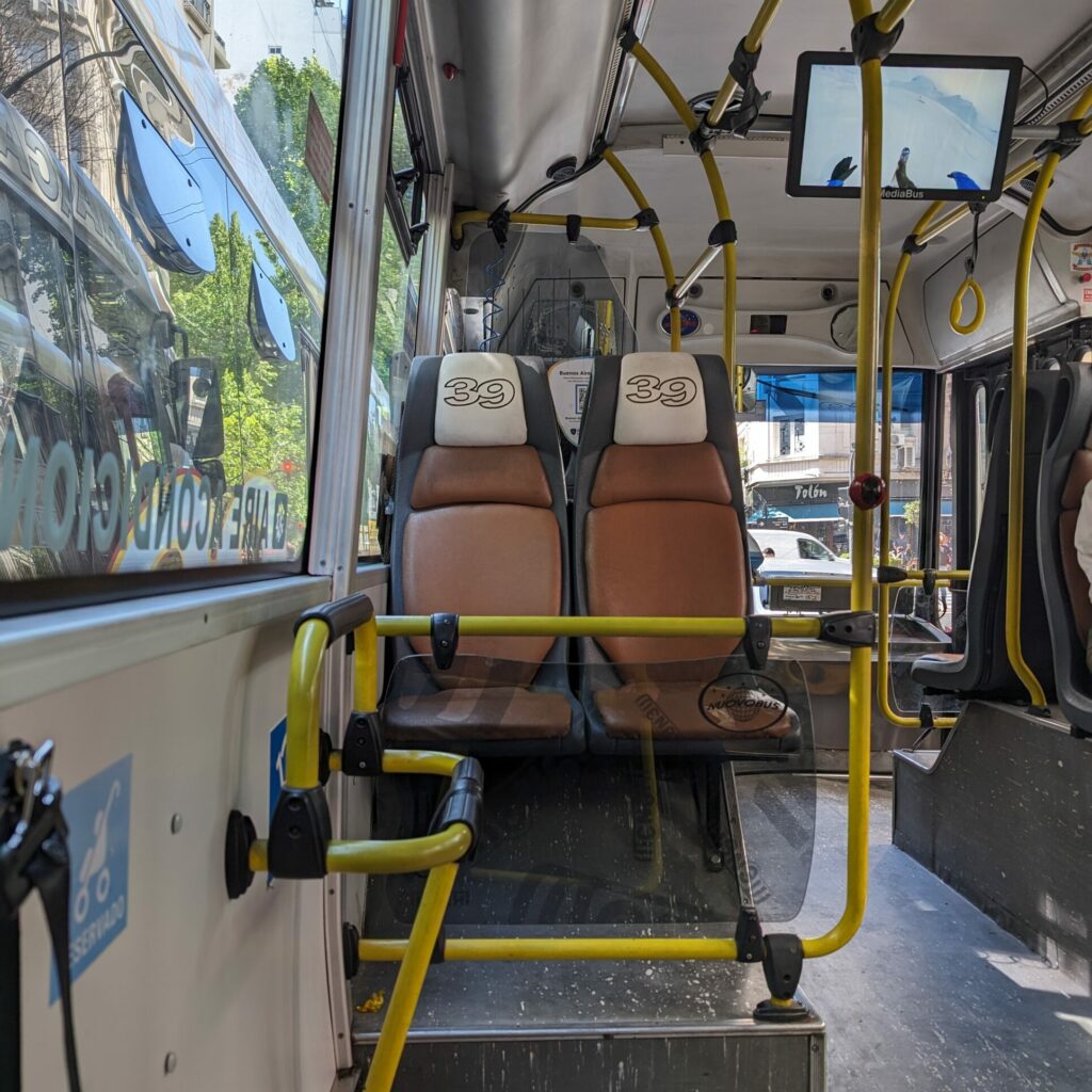
  1. People typically line up single file while waiting for the bus and put their arm out to wave down the bus as it comes by. If you don’t wave down the bus, they will just skip over your stop.
  2. Once the bus stops, get on the bus as quickly as possible because the bus driver will be itching to leave the stop. You will need to tell the bus driver where you are getting off so he can appropriately charge you and then you hold your card against the Sube card reader until it gives you the green light.
  3. Find your seat on the bus or stand to the side if the bus is full.
  4. To get off the bus, make your way towards the middle or back doors and press the button on the pole by the doors. The bus driver will not stop unless you press the button to indicate that you want to get off at the next stop.

This has been our favorite way to navigate Buenos Aires and if we can do it, you can do it!

Disclaimer: We have not used the following forms of transportation yet but wanted to share them for your use

Free Bikes! No Way!

You may see some orange bikes around the city. These are Ecobicis and are free to use for 30 minute increments 4 times a day. However, you will need to download the application (linked here) and create an account. You will need data to use the app to take out a bike. Many bike lanes in the city are protected from cars and the city is relatively flat.

Taking a Taxi to Navigate Buenos Aires

Taxis are prolific within the city and can be spotted with their black body and yellow roofs. When they are available, many say “Libre” (free) in the window or on the top of the roof. Make sure that the driver starts the meter at zero when you get in the car. You can give the driver the cross streets of your destination or the name of the destination if it is a known attraction. It is easiest to pay the taxi in pesos.

What About Ubers?

While the city does have some Ubers, you may have to wait before getting one. This is the most expensive way to navigate Buenos Aires (from this list) but it will not break the bank. It is also secure if you are nervous about getting from place to place.

Share This Article
Facebook LinkedIn Copy Link
Contents
Walking Around the CityUsing Public Transportation to Navigate Buenos AiresFree Bikes! No Way!Taking a Taxi to Navigate Buenos AiresWhat About Ubers?

You Might Also Like

Ecuador

The Best Way to Spend Time in Cuenca, Ecuador

Travel Blog

Update 35: An Introduction to Colombia by Visiting Bogota

Travel Blog

Update 41: Rich Culture, Food, Mezcal and More in Oaxaca

Travel Blog

Update 30: Exploring the Diverse Landscapes of Ica, Peru

About Blueprint Travelers

Blueprint Travelers was founded in 2023 by Kevin and Melina, avid travelers who decided to pack up their home and travel the world. They created this travel website to help and inspire others to make the most of their world travels, focusing on comfortable and cultural travel in South America, Australia and New Zealand.

All of the content that you will find on this website comes from first hand experience to make sure that the information is valuable and accurate. It includes destination itineraries, logistical explanations, and cultural observations. Overall, the goal of this website is to give you the blueprint to travel to the fullest! 

Read More About Who We Are

Join our newsletter

Once a week, we will send you an update on our travels along with some travel tips.

Wellington is both the political and culture capit Wellington is both the political and culture capital of New Zealand. It’s also the port city for the ferry that goes to the South Island, making it a hub for travelers going between the two islands. So what is there to do here?

🖼️ Museum Of New Zealand Te Papa Tongarewa @te_papa is the best place to go to get an understanding of New Zealand, including exhibits celebrating Māori history and culture

🎭 Cuba Street and the surrounding area is known for its bohemian and artistic flair. It is full of boutiques, restaurants, bars, cafes, and street performers. 

🦜 Zealandia Te Māra a Tāne @visit_zealandia is a native wildlife sanctuary in Wellington, New Zealand, focused on restoring the ecosystem of plants, birds, fish, reptiles, insects, etc that are native to New Zealand. 

🎥 Weta Workshop @wetaworkshop is a creative company that was used for the Lord of the Rings movies, developing the prosthetics, costumes, weapons, and creatures for the movies. They have daily tours to explain their creative process. 

⚖️ For those who are interested in how other countries operate, you can visit New Zealand’s parliament building in a free guided tour for anyone. 

And there’s even more on our website. 🔗 Link is in the bio. 

📍Wellington, North Island, New Zealand

#wellington #wellingtonnz #newzealandguide #newzealandtravelguide #newzealandtourism #newzealandtraveltips
The beautiful landscapes of the South Island of Ne The beautiful landscapes of the South Island of New Zealand: from the mountains 🏔️ to tropical beaches 🏝️

📍South Island, New Zealand

#southislandnewzealand #newzealandlandscape #newzealandlandscapephotography #newzealandtravel #newzealandtourism #visitnewzealand #tourismnewzealand #newsealandtravelguide #newzealandnature #southislandtourism
🏝️ Can you believe that this is New Zealand? 🏝️ Can you believe that this is New Zealand?

✅ Tropical rainforest
✅ Secluded white sand beaches that you can hike to
✅ Gatorade cool blue colored water

In Abel Tasman National Park, you can hike to different beaches like this and indulge in a secluded paradise. You can read more about visiting the idyllic location on our website. 🔗 Link is in the bio. 

📍Abel Tasman National Park, South Island, New Zealand

#abeltasmannationalpark #abeltasmancoasttrack #newzealandbeaches #newzealandtravelguide #newzealandtrip #abeltasmanbeach #newzealandvacations #underrateddestinations #newzealandtravelblogger #travelphotography #newzealandfinds
Follow on Instagram

Search This Website:

Destinations:

  • Argentina
  • Australia
  • Bolivia
  • Brazil
  • Chile
  • Colombia
  • Ecuador
  • Mexico
  • New Zealand
  • Paraguay
  • Peru
  • Uruguay
Travel Article Archive

About Us:

About Us
Work With Us
Our Travel Journal
  • Social Media Links

Some links on our website are affiliate partners. If you choose to purchase through these links, we receive a small commission at no extra cost to you. By using them, you are directly supporting Blueprint Travelers to continue to provide resources that help you make the most of your travel adventure.

Copyright © 2025 Blueprint Travelers LLC. All rights reserved. No part of this site may be reproduced without our written permission.

  • Privacy Policy
  • Disclosure Policy
  • Terms and Conditions
Welcome Back!

Sign in to your account

Username or Email Address
Password

Lost your password?